Villa Medici in Historic Maps and Engravings - Then vs Now
Explore Villa Medici through historical maps and engraved views to understand changing urban perception in Rome.
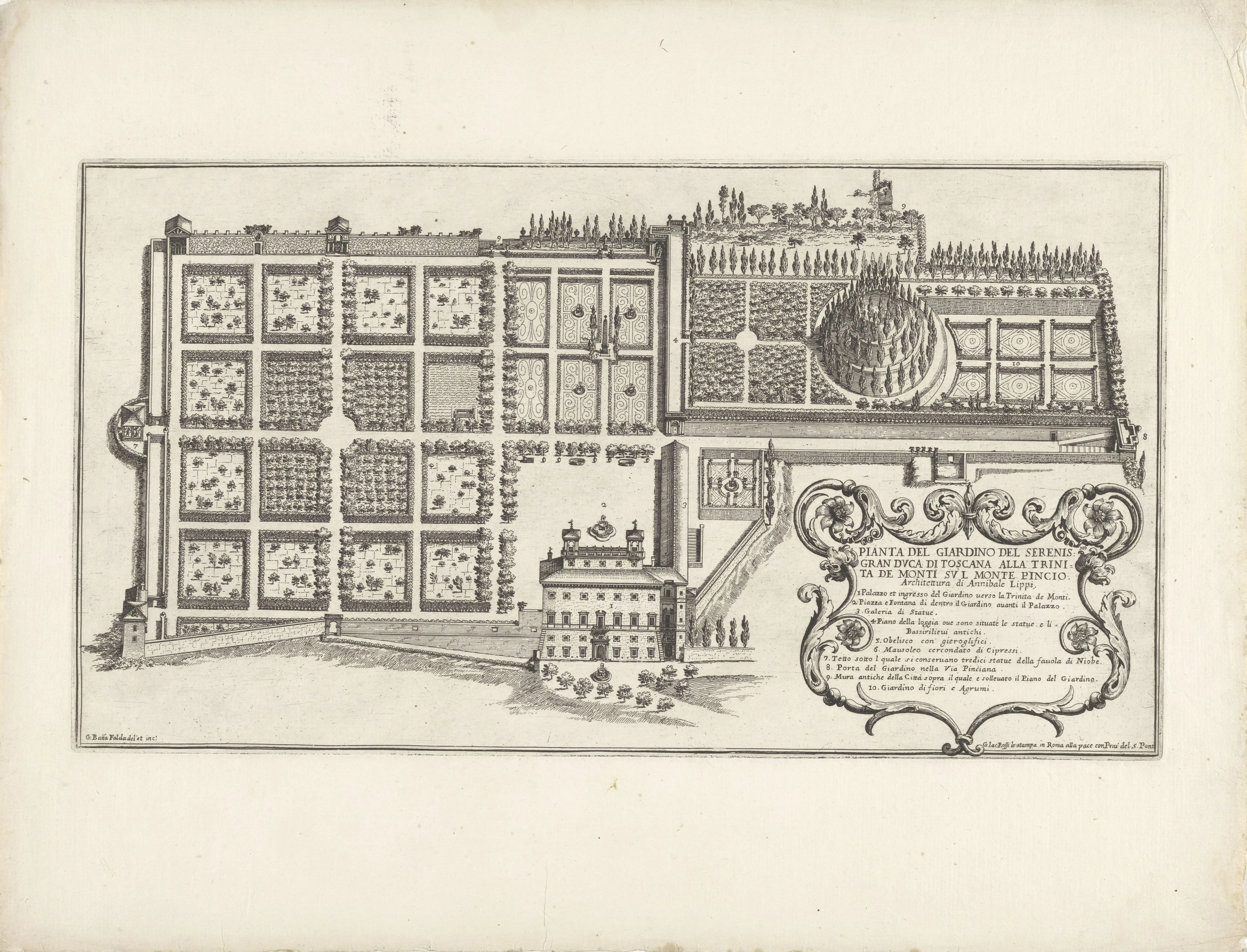
Maps and engravings are not passive records. They are curated arguments about what deserves attention.
Why historical images matter
They show:
- what was emphasized,
- what was omitted,
- how vantage points were staged,
- and which narratives were legitimized.
Suggested comparative method
| Step | Action |
|---|---|
| 1 | Choose one historic view |
| 2 | Identify axis and framing |
| 3 | Visit current viewpoint |
| 4 | Compare skyline density |
| 5 | Note what changed in meaning |
Sources you may encounter in visual history context
- Falda-style panoramic logic
- Piranesi-influenced dramatic framing
- Later cartographic rationalization
Micro exercise on site
- Open historical image on phone.
- Stand at approximate angle.
- Capture "echo photo" today.
- Write 2 differences + 1 continuity.
Historical maps train your eye to detect editorial choices. Every engraved line, omitted block, and emphasized axis reflects a decision about what mattered to viewers of that era.
When you stand on site with an old image in hand, you are effectively comparing two curators: the historical draftsman and your contemporary self.
That comparison is deeply rewarding because it reveals not just what Rome changed, but what each period wanted Rome to mean.
Bottom line
Reading Villa Medici through old images teaches you a crucial Rome skill: every view is edited, and every edition has an agenda.
저자 소개

Rome Heritage Editor
이 가이드는 여행자가 SNS의 짧은 이미지 너머로 빌라 메디치를 발견하도록 돕기 위해 작성되었습니다. 예술적 무게, 역사적 층위, 인간적 이야기를 이해한 뒤, 실용적 명료함과 정서적 깊이를 함께 갖춘 방문을 경험하도록 하는 것이 목표입니다.
Tags
Comments (0)
Loading comments...